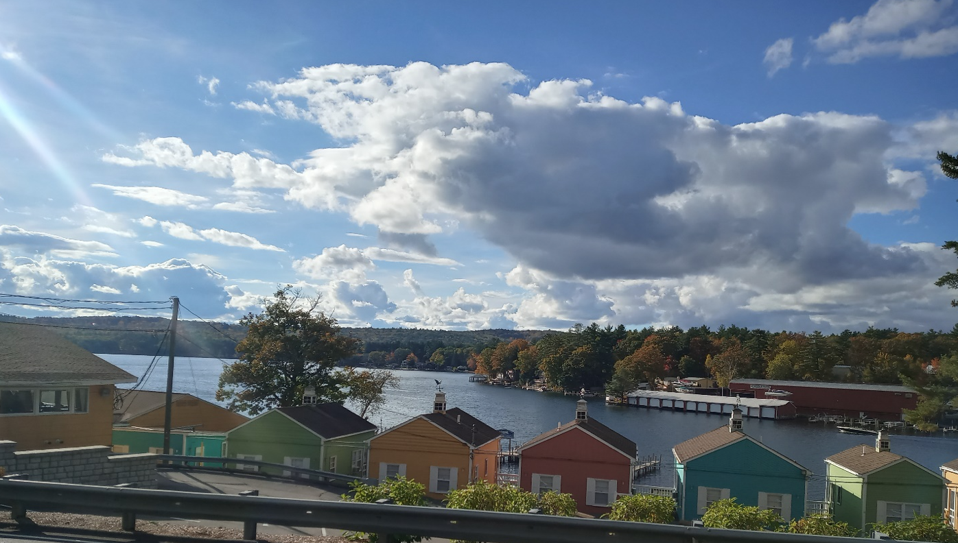
View of Lake Winnipesaukee’s Paugus Bay from Route 3 on the way to Weir’s Beach
Looking for a new cycling adventure? How does 5 rail trails and 13 lakes sound? Welcome to the Cross New Hampshire Lakes Trail!
By now you have probably read about or ridden the Cross New Hampshire Adventure Trail from Woodsville, NH to Bethel, ME. New Hampshire Rail Trails Coalition (NHRTC) board member Marianne Borowski has done an amazing job of organizing and promoting this cross-state adventure. (My wife and I rode the xNHAT two years ago and I wrote about some of the adventures we enjoyed. Randolph-to-Littleton, Ammonoosuc Rail Trail.)
This new Cross New Hampshire route that you have not yet heard of has a lot going for it – including utilizing five rail trails, passing by thirteen lakes and ponds, and cruising across Lake Winnipesaukee on the M/S Mount Washington. I hope you’ll read on and join me as I describe the fun route. It doesn’t have a fancy website (yet), so use this link to access the full map on RideWithGPS.
Starting on the west side of the state at the Connecticut River in West Lebanon (Figure 1), at Bridge Street Park, Stateline Sports or the Four Aces Diner, our goal is to reach the trailhead of the Mascoma River Greenway on Glen Road. First, head west on Bridge Street, then west on Main Street until the intersection with Glen Road at 1.4 miles, where a sharp right turn takes you down Glen Road. Another 0.2 miles takes you to the west trailhead of the Mascoma River Greenway, an excellent paved trail that follows the Mascoma River, including passing through the new tunnel in Lebanon for 2.8 miles before meeting the start of the Northern Rail Trail (NRT) in Lebanon. Read more about it here: https://nhrtc.org/fall-on-the-northern-rail-trail/
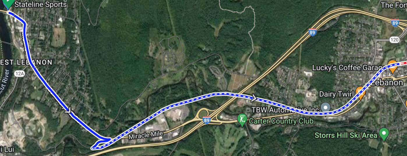
Figure 1. Map of West Lebanon Road Section and Mascoma River Greenway
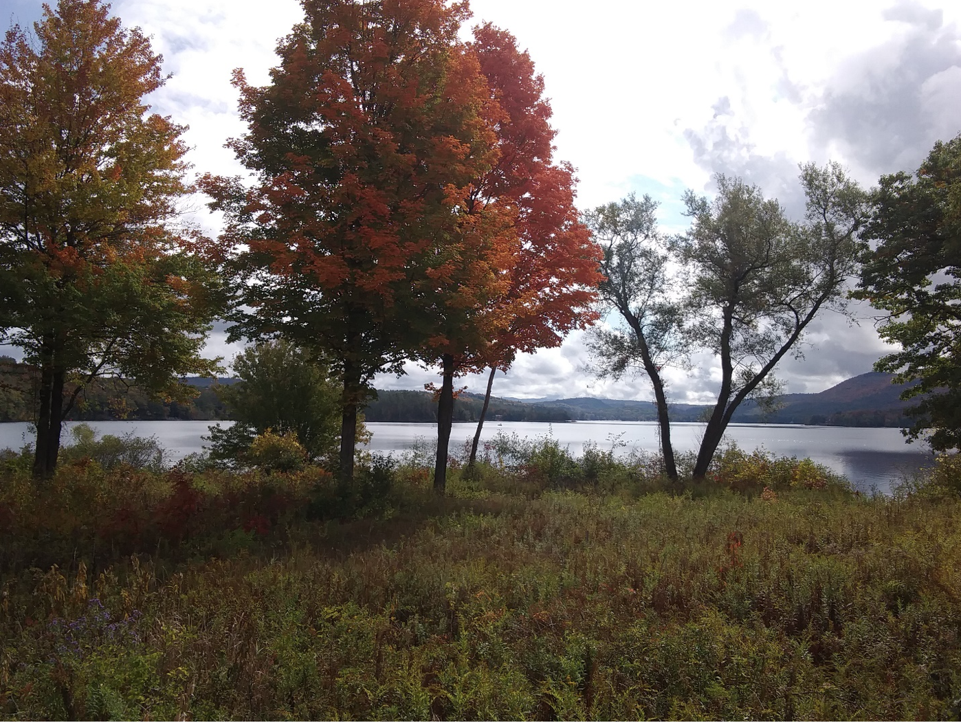
Figure 2. Mascoma Lake from the Northern Rail Trail.
From there, follow the NRT for 32.2 miles past Mascoma Lake (Figure 2), Mirror Lake, Cannan (possible lunch stop), Danbury (another food stop) to Cioffi’s Landing on Eagle Pond. From there get on Rt. 4 to New Canada Road for 0.7 miles to the New Hampshire Mountain Inn, (Figure 3). Alternatively, catch a ride to an AirB&B at Ragged Mountain or in Danbury. Your first day will total 37.1 miles, what we would normally consider to be reasonable for comfort bike riders like my wife and me.
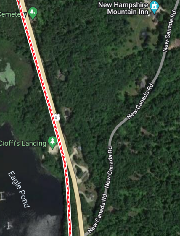
Figure 3. Cioffi’s Landing near Danbury
The second day starts again from Cioffi’s Landing, back on the NRT, continuing west past Potter Place RR station, Keniston Covered Bridge, Highland Lake, Andover, to Webster Lake (Figure 4) and exits the NRT after 14.5 more (mostly downhill) miles at the Franklin Congregational Church, where the route crosses Main St. and follows Central St. for one mile to the trailhead for the Winnipesaukee River Trail at Trestle View Park (Figure 5). From there the Winnipesaukee River Trail traverses 5 miles to the intersection with Route 140 in Tilton. Along this route it parallels the Winnipesaukee river, which flows out of the lakes region. In downtown Tilton is another short on-road and side path section, as shown in Figure 6. This trail also includes one of the sections of “Rail-with-Trail” along this route.
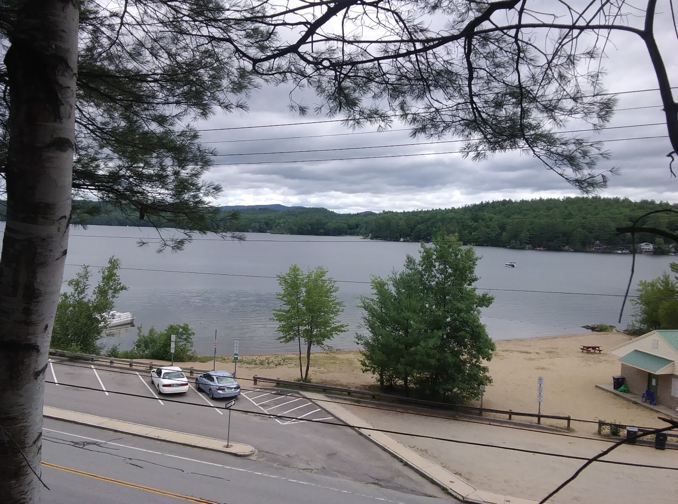
Figure 4. Webster Lake in Franklin has a public swimming area near the trail
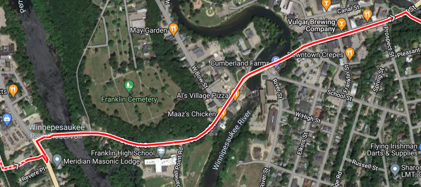
Figure 5. Road section through Franklin Falls, connecting the Northern Rail Trail and the Winnipesaukee River Trail (1 mile)
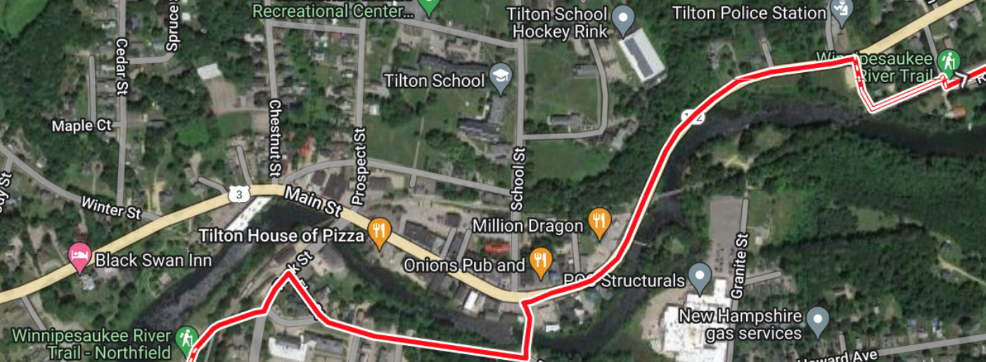
Figure 6. Short on-road and side-path section in Downtown Tilton
When you arrive in Tilton at Rt. 140, you will have ridden over 20 miles for the day, and it might be time for lunch at the Tilton Diner. At this point you will need to tackle the road section to the next trail, the Lake Winnisquam Scenic Trail, that starts up in Belmont at the Osborne Garden Center. This is because the next rail-with-trail section has not yet been continued from Rt. 140 to Silver Lake Road in Tilton. The most direct route is to take Rt. 3 east past the restaurants and outlet malls of Tilton. While traffic can be strong here, the road does have a wide, paved shoulder. If you have a mountain bike and want to get off Rt. 3 for a short excursion near the rail line, you can turn right at Manville Road, cross the tracks and follow it to 1 Paper Trail, a dirt trail that parallels the railroad for almost a mile before you need to turn left on Noyes Road to go back to Rt. 3. If you’re on a road bike just put your head down, and watch your rear view mirror and book it a couple miles up Rt. 3 to make a right on Brook Road which turns into Silver Lake Road. This crosses the Winnipesaukee River between Silver Lake (south) and Lake Winnisquam (north). Soon after that make a left on Union Road, which after 4.5 more miles will intersect with Rt. 3/11, Daniel Webster Highway again, at Piche’s just up from the entrance to the Lake Winnisquam Scenic Trail (Figure 7). This trail is an adaptation that does not follow the RR line, but uses some state reserved wetland to connect with the rail line near the Belmont/Laconia line. Be ready for some hills, since this trail is not on the railroad line, but it is paved. If it gets too steep, there is no shame in getting off and walking your bike. If people want to criticize, ask them if they are biking *across the darn state for goodness sake!*
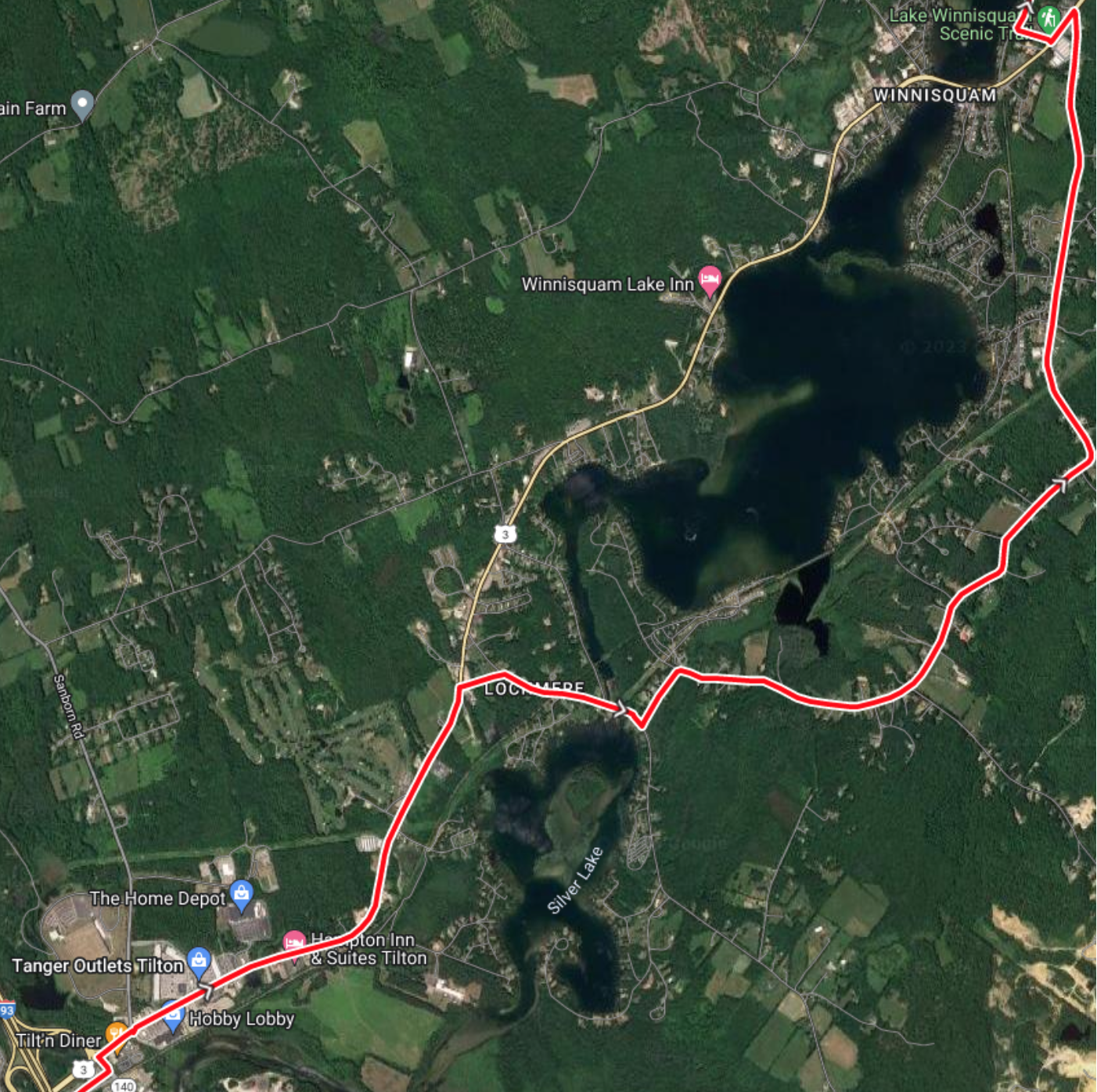
Figure 7. Road section connecting the Winnipesaukee River Trail in Tilton with the Winnisquam Scenic Trail in Belmont
Once on the WoW Trail (Winnisquam, Opeechee and Winnipesaukee Trail) follow it through Laconia, stopping for the night at one of several available hotels, (e.g. Best Western Landmark is the first and closest to the Trail), This will make your trail mileage for the day just about 30 miles. Stop for dinner and explore Laconia on the river between Opeechee and Winnisquam. If you’re feeling energetic, take a ride up past the old Depot, where rail bikes are rented in the summer, follow Pleasant St., turn left on Gale St., right on Holman and left on Shore Drive and follow the route of the future Opeechee Loop trail all the way up to where it will enter Ahern State Park (2.7 miles one way). It’s a beautiful ride on a residential street along the sunset shore of Lake Winnisquam.
The next morning you’ll want to get an early start, so after a delicious breakfast at the Water Street Café, (just one of many good options), you’ll get back on the WOW trail at the Laconia Depot (Figure 8) for the ride to Weir’s Beach by 10 am (or 12:30) to catch the MS Mount Washington departing from Weir’s Beach for Wolfeboro, NH on the east side of Lake Winnipesaukee. The WOW trail continues its Rail-with-Trail ways 1.8 miles along the shore of Lake Opeechee until it reaches Elm Street in Lakeport, which is an area where the Winnipesaukee River drains out of Paugus Bay (Lake Winnipesaukee) into Lake Opeechee. This is where the rail line follows the north side of Paugus Bay to Weir’s beach, which you can see by taking the Winnipesaukee Scenic Railroad tour of this area. This is where you’ll be required to pull up your biking shorts and get back on the road to get to the M/S Mount Washington Dock at Weir’s Beach.
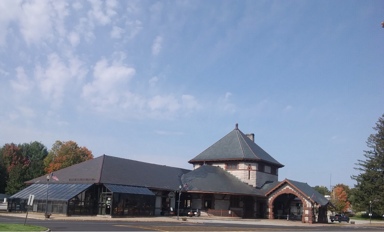
Figure 8. Old brick depot in downtown Laconia, now home of restaurants and rail bikes.
My preferred route is this (Figure 9): Take Elm Street/Clinton Street across Union Ave (Rt. 107) and turn left on Mechanic Street. Mechanic Street has a steep hill, so detour around it by taking a right on Manchester St. and a left on Valley Street, which will take you up to Stark Street where you turn left and then right back onto Union Avenue (0.7 miles). At this point, Union Avenue is narrow and has traffic, but this segment is short (0.6 miles). Either jump on the road and spin the cranks or walk this distance on the sidewalk to McDonalds. Just before McDonalds a bike/ped path takes off to the right from Union Avenue. This is a remaining section of the historic Lakeshore railroad that came to Lakeport from Rochester, NH, but was abandoned in 1901, nearly 125 years ago! On this section if you look to the left in the trees along the bike path, you can see steel rails still there. Additionally, some of the railroad right of way is still owned by the state along the south side of Paugus Bay, which could possibly replace the road sections along Union Avenue. The bike/ped path meets Blaisdell Avenue, which rejoins Rt. 3 at CVS (1.5 miles from Lakeport) and continues to Weir’s beach. This section of Rt. 3 is busy, but also has wide shoulders and the 3.9 miles to Weir’s beach goes quickly, with beautiful views of Paugus Bay to the left. So the total mileage to Weir’s beach is only about 7.2 miles, which should be doable to catch to 10am boat for early birds, or the 12:30 boat for later risers. Make sure to arrive at least a half hour before sailing. Ask to take your bike on the boat so you can continue your ride from Wolfboro on the Cotton Valley Rail Trail. For now, sit back and enjoy the beautiful view as you sail the M/S Mount Washington across Lake Winnipesaukee. Why else would this be called the Cross New Hampshire Lakes Trail?
When you get off at the dock in Wolfeboro, the Cotton Valley Trail begins next to the old depot in Wolfeboro. From the dock, cross Main Street and follow Railroad Avenue past the depot (restrooms available) to the beginning of the Cotton Valley Rail Trail. This 12 mile trail meanders along Crescent Lake and Lake Wentworth on its way from, Wolfeboro to Wakefield, where the Boston and Maine Turntable can be seen in Turntable Park. A serious word of warning here: this rail-with-trail is an unusual one, which runs outside and between the rails. This trail is shared with walkers, bikers and speeder cars, which also help to maintain the trail. This trail in some ways is first and foremost a trail for the rail car club, which stores their cars at the Cotton Valley Station. So, use this as a new opportunity to share the trails with others and appreciate the work they put into making the trail available for all. But be careful when crossing the tracks to go off or between the rails. Your front wheel can slip and you can go down, and a few folks have had their rides ruined this way. The signs say “walk your bike”, so if you have any doubt about your ability to cross the rails, “Walk it”, as it could save you a trip to the hospital! Hey, this is an adventure trail too!
When you reach Wakefield, you are still not across the state, and the ultimate destination is the boat launch parking lot on Horn Pond at the Maine State line. There are two ways to get there. For road bikes, take Route 109 along the south side of Lovell Lake (5.7 miles). For mountain or hybrid bikes, I prefer the dirt road that follows the north side of Lovell Lake and joins Rt. 109 to continue to the state line. (Figure 10) The roads for this route are Rt. 109 to Witchtrot Road (I love this name). Then make a right on Brackett Road, which joins Pond Road and finally Oak Hill Road which meets Rt. 109. Meet your party at the Horn Pond Boat launch and return to your location of choice! Happy riding!
Photos, research, maps, explorations, writing – all by NHRTC Board member Rich Westhoff
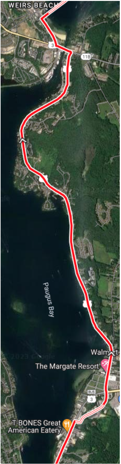
Figure 9. Road Section connecting WOW Trail with Weirs Beach
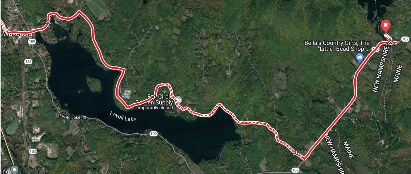
Figure 10. On road section from Wakefield to the Maine State Line via the north side of Lovell Lake