Cross-New Hampshire Adventure Trail – Presidential Rail Trail
Our second day on the Cross-NH Adventure trail last June started from the highest point on the Presidential Rail Trail, the Castle Trailhead at Bowman, NH, from which we headed west.
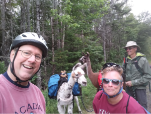
We were on the trail for only a few minutes when we met this man with two llamas. He helps with trail maintenance by packing tools and supplies. This was a photo up we couldn’t pass up.
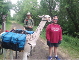
This is Cindy getting a “llama kiss”. They were so cute it was just not possible to not stop to visit.
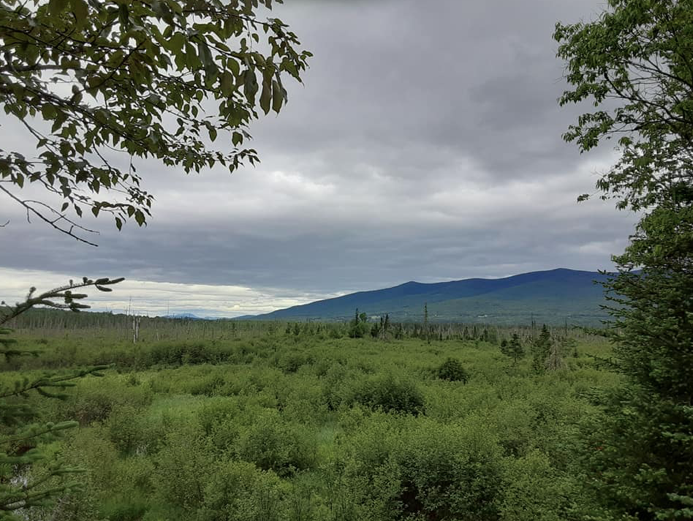
The rail trail section of this ride was gravel with grass growing though to make a single track, but slightly downhill, with a good firm surface for hybrid bikes, but a little too rough for road bikes. We stopped at Cherry Pond to enjoy the beautiful views from the wooden platform.
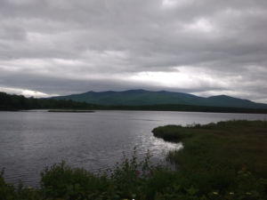
A view of Cherry Pond, near Whitefield, NH taken from the viewing platform
The trail ended at Cherry Pond Trailhead Parking, because the next section of the rail corridor is still used by trains. After that we had to ride roads, with steeper ups and downs than a rail trail, and the cars, loud trucks and motorcycles that made the ride less pleasant. Having hybrid bikes instead of our mountain bikes would have made this section easier.
The route followed Airport Road, and Route 116, to Whitefield where we stopped for lunch.
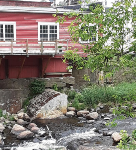
This old mill view was behind the gas station where we stopped to eat our lunch in Whitefield.
We then continued on Route 116 to Cottage Street, South Street, and Riverside Street to Industrial Park Road and the Ammonoosuc Rail Trail Parking lot in Littleton. If we’d have taken Riverglen Lane (instead of South Street) to the bike/ped path to Riverside Street, we’d have found both the Riverwalk Covered Bridge and the Curran Suspension Bridge over the Ammonoosuc River in Littleton. http://www.upstatenh.com/Recreation/LittletonNHDowntownRiverWalk.html
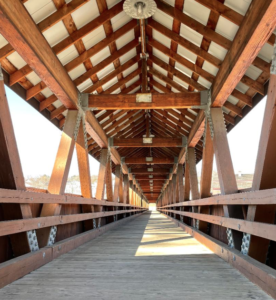
At the end of Riverglen Lane is the access to Riverwalk Covered Bridge, providing a beautiful view of the river and a path to the restaurants on the other side. (Photo credit: Merritt Gifford)
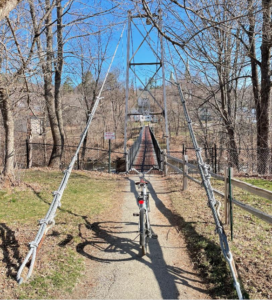
Just before the bike/ped path meets Riverside Drive you will encounter the Curran Suspension Bridge named after the engineer who built it. (Photo credit: Merritt Gifford)
It was about 11 miles on the trail and 16 on roads, so we were pretty tired that night. We were happy that we only rode one way, and did the shuttle run with two cars. An alternative is to use a local shuttle service that you can find on the cross-nh web site under the “Plan your trip” tab: https://www.xnhat.org/ If you’d rather just adventure online, you can explore the trail via this story map: https://storymaps.arcgis.com/stories/2a078e2ed2df4bea9bb6c9cd3fca8a37
-Rich Westhoff
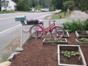
On the road side was this photo op: a clever place to mount your mailbox. It makes it easy to pick up and move!