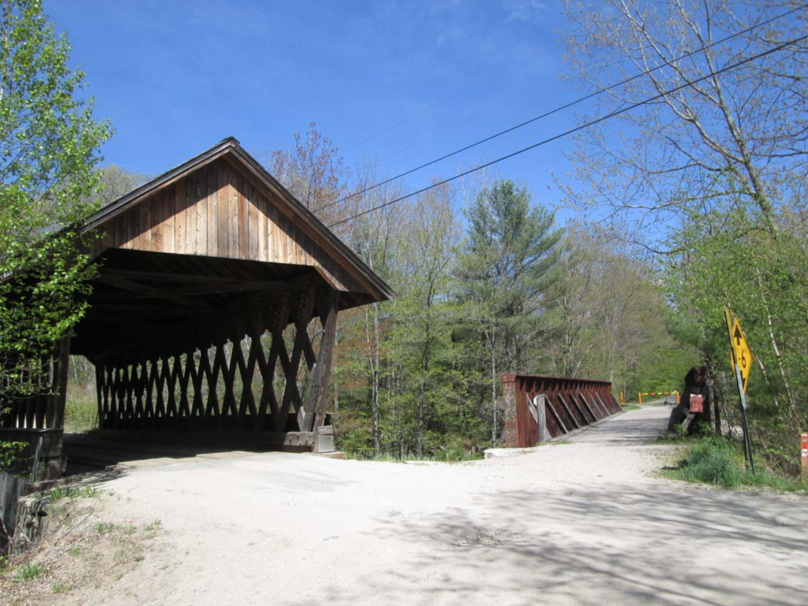
Figure 1. Keniston covered bridge on Bridge Street in Andover, NH is adjacent to the railroad bridge on the the Northern Rail Trail (Photo Credit: Charles Martin)
Even before taking up riding bicycles and walking on rail trails, covered bridges have long been a favorite for a weekend sightseeing journey. It’s possible to combine rail trails with many kinds of bridges, rail trestles, stone bridges, and covered bridges. This article will highlight some of the many opportunities in New Hampshire to use rail trails as an excuse to indulge your covered bridge fascination or vice versa. The advantage to the rail-trail excuse is that you can at least attempt to do some sort of exercise for your health while you are just out sightseeing! If you don’t need a plausible reason to justify your interest in the history and beauty of covered bridges, then just take a bike ride or a walk on the trails for the fun of it! A good reason to see these bridges as an Active Trail User (ATU) is expressed by a quotation from Ernest Thompson’s The Book of Maps: he paraphrases Robert Pirsig’s Zen and the Art of Motorcycle Maintenance as “When you’re viewing the landscape from a car window, it’s a painting. When you’re on a bike, you’re in the painting”!
This topic came up because my wife brought home a new book from the local library, Covered Bridges of New Hampshire by Kim Varney Chandler (hereafter Chandler). This illustrated guide is a delightful, soft-cover coffee table style book chock full of history and photos new and old of the 60+ covered bridges that grace New Hampshire’s many streams and lakes. The only thing it is missing is a map, which of course I found online: https://coveredbridgesnh.com/map/ Another site online with names, locations and descriptions of NH covered bridges is the following: https://www.nh.gov/nhdhr/bridges/table.html
Almost any rail trail on the list of New Hampshire rail trails (https://nhrtc.org/about-3-3/) has some kind of covered bridge on or near it. For example, the Presidential Rail Trail has the boxed pony truss bridge, the Winnipesaukee River Trail has the Sulfite or “Upside-down” covered bridge, and the Peterborough Rail Trail has the Hancock-Greenfield Covered Bridge near its northern end. But several trails have multiple opportunities to see bridges during your ride or on the way to or from the trails. Here are a few:
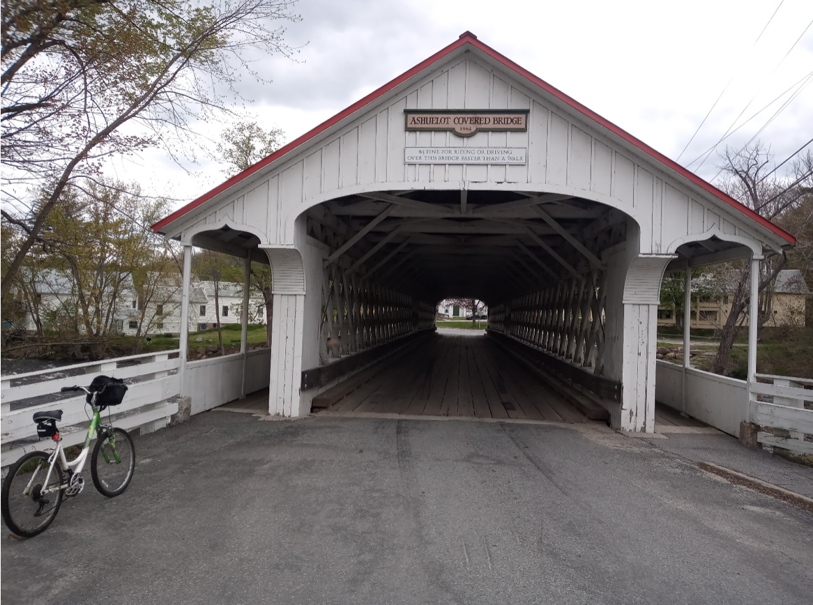
Figure 2. Ashuelot Covered bridge on Gunn Mountain Road in Asheulot, NH is a classic.
Ashuelot Rail Trail
Starting in the southwest near Keene is one of the largest concentrations of covered bridges in the state. Several bridges are accessible from the Ashuelot Rail Trail starting from downtown Keene. https://www.nhstateparks.org/visit/recreational-rail-trails/ashuelot-recreational-rail-trail Head south from the Emerald Street trailhead and after about three miles the trail crosses Sawyer’s Crossing Road, where you can turn left to see and ride across the Sawyers Crossing or Cresson Covered Bridge. The next easily accessible bridge is the Denman-Thompson Bridge on Main St. in West Swanzey. Reach it by bearing left off the rail trail at Railroad Street and following it to Main St. where you make a right to go down to the bridge. Continuing south to where the trail gets a bit rougher, you can make a right on Holbrook Road and take a right on Westbrook Village Road to the Slate Covered Bridge. Further south, after the Rt. 10 crossing, the trail crosses Coombs Bridge Road, where a right turn takes you to the bridge. Finally, along the trail, further south in the village of Ashuelot, (pronounced “ash-we-lot”) is the covered bridge of the same name, on Gunn Mountain Road. This very picturesque bridge is one of our favorites, see Figure 2. Also in the area, but perhaps more easily visited by car is the Carlton Bridge in Swanzey.
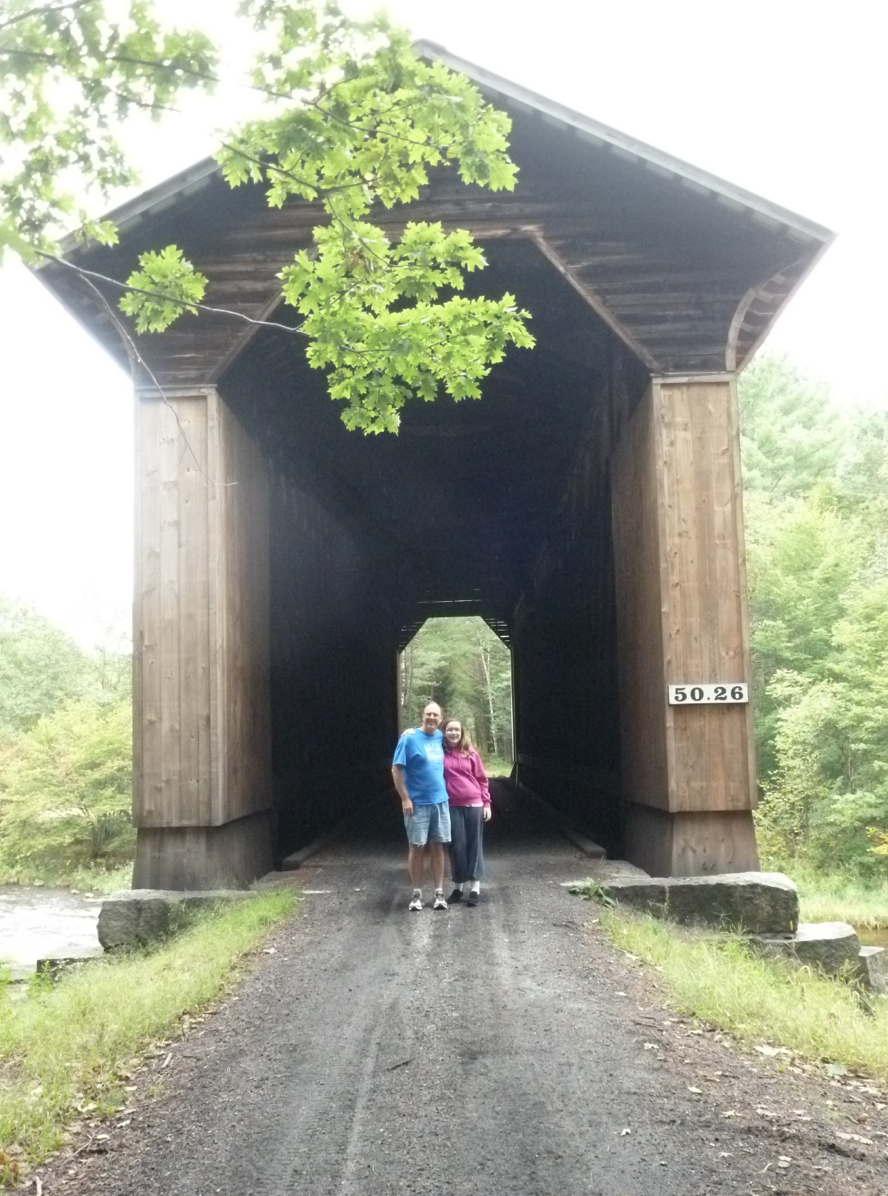
Figure 3. The author and daughter in 2013 at the Wright’s railroad bridge on the Sugar River Trail.
Sugar River Rail Trail
Other rail trails have a few covered bridges, but not many can match the thrill of biking through two of the last 5 remaining railroad covered bridges in the state (with seven remaining in the world). The Sugar River Rail Trail in the central west of the state, between Claremont and Newport provides a scenic riverside view and chance to enjoy these two behemoth bridges. Forget quaint, low-roofed bridges. These engineering marvels were tall enough to accommodate the steam engines of the past. With over 21 feet clearance, these bridges were built to carry over 160 tons (Chandler, pg. 209), compared to vehicular bridges which had load limits of 10 tons (Chandler, pg.110). For scale see figure 3 of the Wright’s bridge with the author and daughter, 10 years ago. The scale of these bridges must be seen to be believed. When one reads that in 1895, that there may have been 1500 of these bridges along the Boston and Maine, it is easier to appreciate the nostalgia of a train ride along these rivers and through these bridges and the effort and money that went into building and maintaining these transportation corridors.
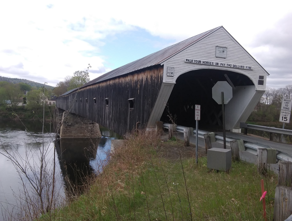
Figure 4. The Cornish-Windsor bridge, the longest wooden bridge in the US, crosses the Connecticut river from NH to VT.
From the eastern end of the trail at 399 NH Route 103, the first one you’ll encounter is Wright’s Bridge, 2.7 miles west of the trailhead (nearest road access is 379 Chandlers Mill Road, an easy walk to the bridge). Note that we ATUs share trail is with OHRV riders, who can access this trail so long as they observe the 25-mph speed limit and meet size and sound regulations. Please share the road here and be courteous so we can all have a safe and enjoyable journey! The second covered behemoth, Pier Bridge, another mile up the road at 259 Chandlers Mill Road is the longest surviving covered railroad bridge in the world at 217 feet long (Chandler, pg.209). The next covered road bridge near the rail trail is another 3.7 miles east on the trail. Where you meet Oak Street, turn left and follow it to Corbin Road for an additional off-road 1 mile trip to Corbin Bridge, named after Austin Corbin, the builder of the Coney Island resort on Long Island in NY and owner of a hunting reserve near the bridge (Chandler, pg.59-60)
On your way to or from the Sugar River Rail Trail you might make the time to stop off to see several other covered bridges, including the Sugar River Bridge in Sunapee and Bement Bridge in Bradford, these are to the east and south of the Sugar River RT. Alternately if you’re heading north/west you could encounter the following bridges, Blacksmith, Dingleton Hill, Cornish-Windsor-Bridge (see Figure 4), or Blow-Me-Down Bridges in Cornish, NH.
Concord-Lake Sunapee Rail Trail
The Concord-Lake Sunapee Rail Trail is an on-going effort to build a continuous rail trail on the corridor of the abandoned Concord- Clarement railroad. So far, a few segments of this trail are complete, and several of them can be easily walked. Nearby covered bridges include the Contoocook Railroad Bridge, (Figure 5) in downtown Contoocook – the oldest of its kind in the world. This bridge is impressive in its size, location and age. Nearby is the start of the Stevens Rail Trail.
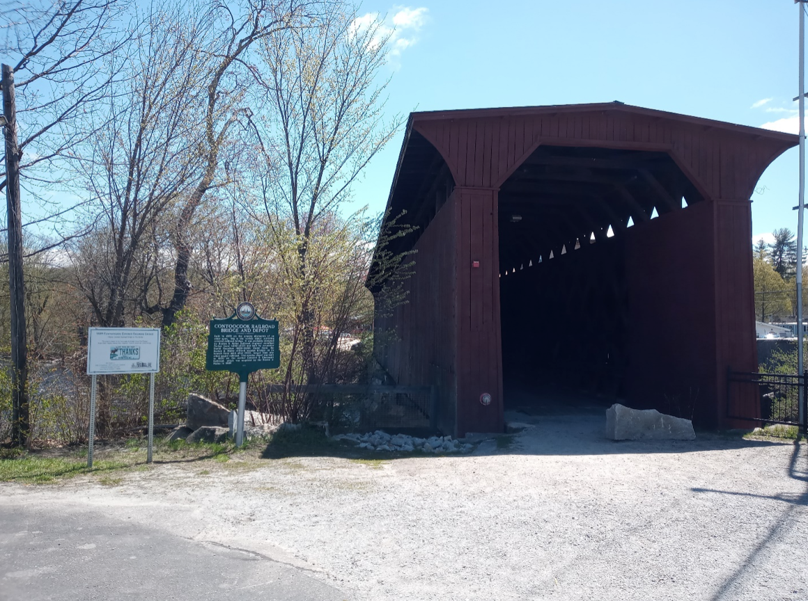
Figure 5. The Contoocook Railroad Covered Bridge is the oldest covered RR bridge in the world.
Further north you can find the Daulton Covered Bridge at Southeast end of the Warner Rail Trail and Story walk, on West Joppa Road in Warner. Other bridges nearby and on the drive to the Tilley-Wheeler Trail are the Waterloo Covered Bridge on Newmarket Road in Warner and the previously mentioned Bement Bridge on Bradford.
Northern Rail Trail
The Northern Rail Trail is a location for more than just the Keniston Covered Bridge pictured in Figure 1. From the station at Potter’s Place, a two-mile round-trip on Cilleyville Road and Johnson Lane takes you to the Cilleyville Covered Bridge, with picnic tables inside for a good place to stop for lunch. Finally, in Lebanon, at the intersection of Hardy Hill Road and Riverside Drive the Packard Hill Covered Bridge can be seen from the bridge on the rail trail just west of the Riverside Drive crossing. At that crossing is a parking lot that provides access to the trail and a 0.3 mile ride west on Riverside Drive to the bridge.
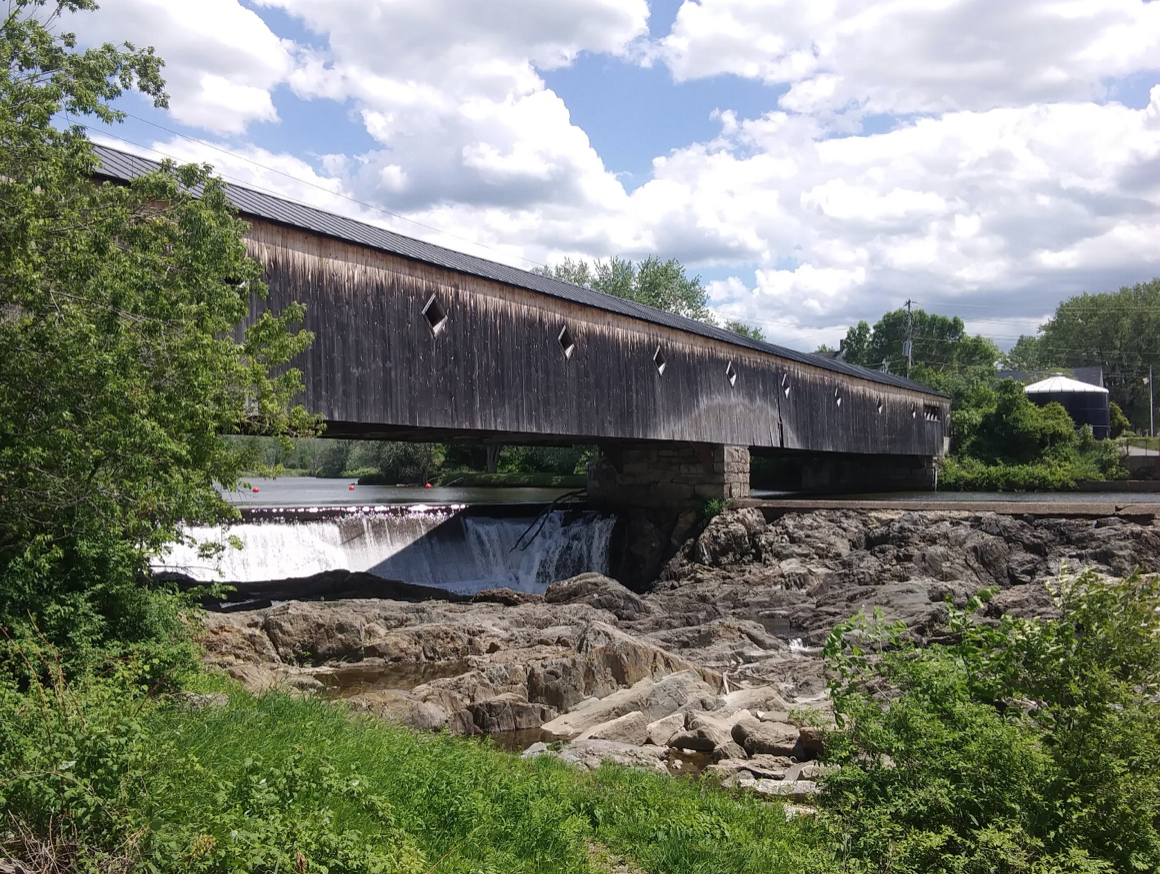
Figure 6. Haverhill-Bath Covered Bridge is the oldest covered bridge in New Hampshire built in 1829.
Woodsville and Ammonoosuc Rail Trails
The Woodsville and Ammonoosuc Rail Trails provide access to some of the most spectacularly sited covered bridges in the state. In Woodsville, the Bath-Haverhill Covered Bridge, (Figure 6) commands its view overlooking the falls on the Ammonoosuc River. The Bath Bridge further upriver provides the opportunity to bike underneath it on the Ammonoosuc Rail Trail. In Littleton, the newly built Riverwalk Covered Bridge connects the rail trail to downtown Littleton.
Additional opportunities abound to find and connect rail trails with covered bridges. I hope that this article has whetted your appetite to get out there and find a few that I have been unable to cover in this article. Happy biking and bridge hunting!